Legal Land Converter Home
Application Programming Interface (API) for Legal Land Converter
Plot a Metes and Bounds Legal Land Description
Plot Land

Search Alberta Corporate Registry

Search Edmonton Alberta property by tax account number, street address, legal desciption & lot / block / plan / unit
Search Edmonton Property
Draw a topographic map of Canada with DLS, Water, Rail and Roads
Draw Canada Topo Map

CSV Search

Links
Links
 

Public Land Survey System


Encrypted Site https://legallandconverter.com/p43.html

PLSS to Latitude and Longitude

 Qtr Qtr Qtr  Qtr Qtr  Qtr/Lot     Section   Fraction 
 
 Township   Fraction   N/S     Range   Fraction   E/W 
 
State
Meridian  County 

Note: Only a Meridian or a County is required, not both.

Note: Fractions are Rare. If in doubt, Leave Fractions Blank

Example:
S2 T35N R21W Chisago County, Minnesota
Section 2, Township 35 North, Range 21 West, Fourth Principal Extended


Latitude and Longitude to PLSS

GPS Location
Latitude Longitude

Example:
Latitude 37.96197   Longitude -121.81423


Latitude   Longitude
Degree Minute Second N/S   Degree Minute Second E/W
 

Example:
Latitude 37° 57' 43" N   Longitude 121° 48' 51" W


Public Land Survey System (PLSS)

The Public Land Survey System (PLSS) is the surveying method used in the United States to divide real property.

It is regulated by the Bureau of Land Management (BLM).

Common Names for this System of Land Surveying

  • Legal Land Description
  • Public Land Survey System
  • Rectangular Survey System
  • United States Public Land Survey
  • Rectangular System of Surveys
  • U.S. Government Survey
  • Official Government Survey
  • Township and Range System
  • "According to the Government Survey Thereof"


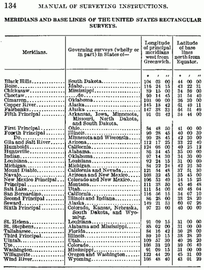
Principal Meridians and Base Lines
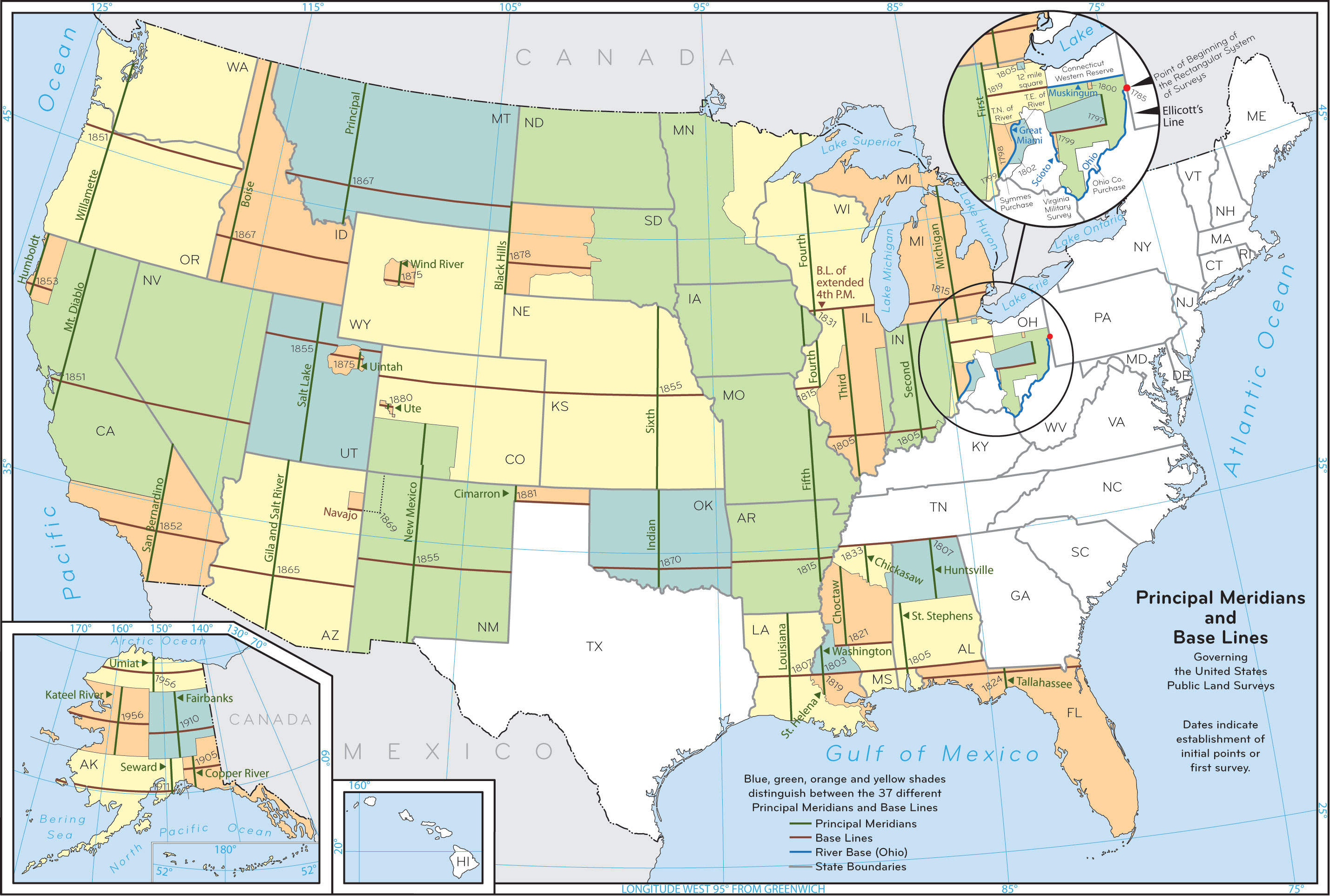
US Public Land Survey System - Principal Meridians and Base Lines
Meridians and Base Lines of the United States

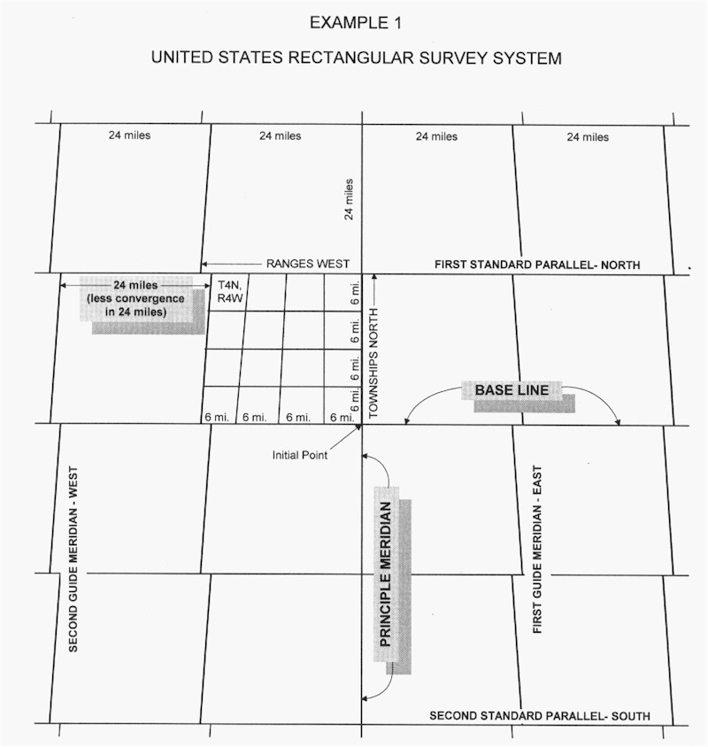
Rectangular Survey System

United States Rectangular Survey System

Township Numbering Diagram

US Public Land Survey System - Theoretical Township Numbering Diagram - Showing method of numbering sections with adjoining sections.

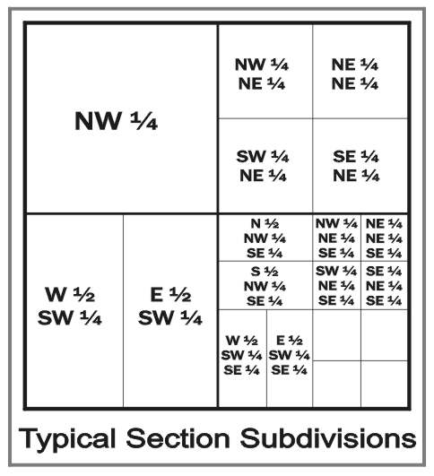
Typical Section Subdivisions

US Public Land Survey System - Typical Section Subdivisions

Section Subdivisions
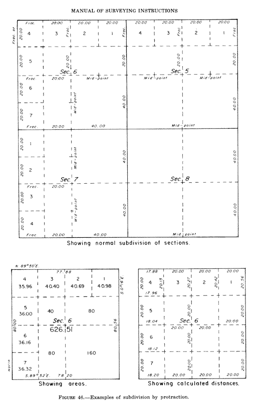
US Public Land Survey System - Examples of Subdivision by Protraction

Original T1S R1E Mount Diablo Survey Plat
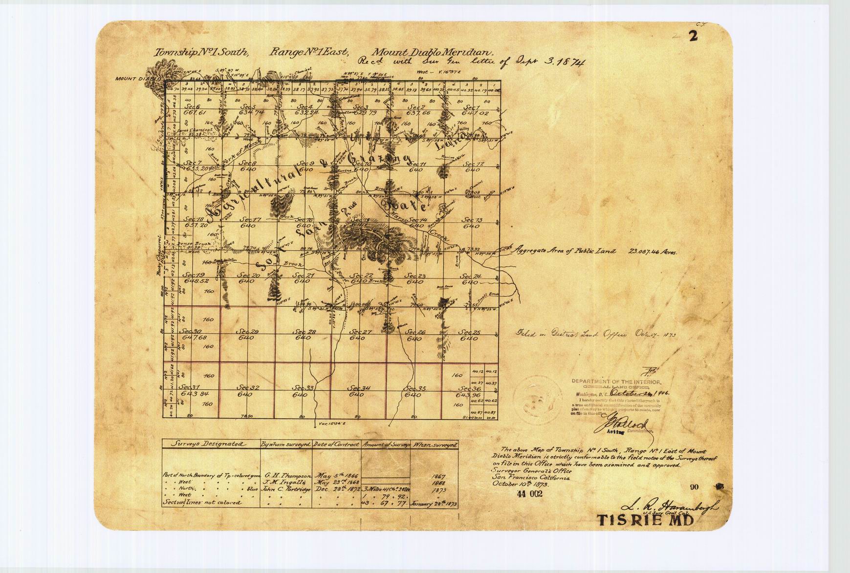
US Public Land Survey System - Original T1S R1E Mount Diablo Survey
Setting up an Account
 
Login

Create an Account

Purchase Credits

Retrieve Lost Password

How to Set Up
an Account

Canada Dominion Land Survey (DLS & ATS) Converter

Canadian Batch Converter
Canadian Batch Converter Help

US Public Land Survey System (PLSS) Converter
PLSS Batch Converter

Military Grid Reference System (MGRS)

National Topographic System (NTS)

Federal Permit System (FPS)

Universal Transverse Mercator (UTM)
Contact Us

Legal Land Converter
Edmonton, Alberta
Phone: 780.455.7226
contact@legallandconverter.com
Copyright © 2024