for Legal Land Converter")


National Topographic System
NTS to Latitude and Longitude
Example: C-26-F/93-K-11
Series 93, Area K, Sheet 11, Block F, Unit 26, Quarter C
Latitude and Longitude to NTS
Example:
Latitude 54.60625
Longitude -125.32188
Example:
Latitude 54° 36' 22" N
Longitude 125° 19' 18" W
Executive Summary
The National Topographic System (NTS) system is used:
|
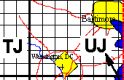
Map showing NTS Grid Coverage

NTS Grid Expansion

National Topographic System File LayoutFields listed in size order, from largest to smallest. |
|||
| Field Number |
Name | Map Scale |
Description |
| 1 | Series | 1:1,000,000 |
4° Latitude Tall (All Zones)
16° Longitude Wide (80° to 88° N) High Arctic Zone
   High Arctic Zone
                             560,340,120,

      Arctic Zone

                99, 89, 79, 69, 59, 49, 39, 29,
                98, 88, 78, 68, 58, 48, 38, 28,
       117,107, 97, 87, 77, 67, 57, 47, 37, 27,

      Southern Zone

       116,106, 96, 86, 76, 66, 56, 46, 36, 26, 16,
       115,105, 95, 85, 75, 65, 55, 45, 35, 25, 15,
       114,104, 94, 84, 74, 64, 54, 44, 34, 24, 14,
           103, 93, 83, 73, 63, 53, 43, 33, 23, 13,  3,
           102, 92, 82, 72, 62, 52, 42, 32, 22, 12,  2,
                                51, 41, 31, 21, 11,  1,
                                    40, 30, 20, 10
|
| 2 | Area | 1:250,000 |
8 Areas 2x4 (A to H) (80° to 88° N) High Arctic Zone 8 Areas 2x4 (A to H) (68° to 80° N) Arctic Zone
       H G
       E F
       C D
       B A
16 Areas 4x4 Grid (A to P) (40° to 68° N) Southern Zone
       M N O P
       L K J I
       E F G H
       D C B A
|
| 3 | Sheet | 1:50,000 |
16 Sheets in a 4x4 Grid (1 to 16)
      13 14 15 16
      12 11 10  9
       5  6  7  8
       4  3  2  1
|
| 4 | Quarter | 1:12,500 |
4 Quarters in a 2x2 Grid (A to D)
      C D
      B A
|
| 5 | Unit | 1:1,2500 |
100 Units in a 10x10 Grid (1 to 100)
      100  99  98  97  96  95  94  93  92  91
       90  89  88  87  86  85  84  83  82  81
       80  79  78  77  76  75  74  73  72  71
       70  69  68  67  66  65  64  63  62  61
       60  59  58  57  56  55  54  53  52  51
       50  49  48  47  46  45  44  43  42  41
       40  39  38  37  36  35  34  33  32  31
       30  29  28  27  26  25  24  23  22  21
       20  19  18  17  16  15  14  13  12  11
       10   9   8   7   6   5   4   3   2   1
|
| 6 | Block | 1: |
12 Units in a 4x3 Grid (A to L)
       L K J I
       E F G H
       D C B A
|
   Programmer's Cheat Sheet for NTS


   // IN AREA ORDER

   SERIES  0 to 120           1st   4 x 8 or 4 x 16   1:1,000,000

   AREA    A to P or A to H   2nd   16 or 8 zones     1:250,000 4x4 or 2x2

   SHEET   1 to 16            3rd   Always 16         1:50,000  4x4


   QUARTER A to D                                     1:12,500  2x2

   UNIT    1 to 100                                   1:1,2500  10x10

   BLOCK   A to L


   // IN DISPLAY ORDER

   Example: C-26-F/93-K-11

   // IN ENGLISH

   Series 93, Area K, Sheet 11, Block F, Unit 26, Quarter C

   // IN C

   printf("NTS\n");

   printf("%s-%s-%s/%s-%s-%s\n",mapquarter,mapunit,mapblock,mapseries,maparea,mapsheet);