|
|
 for Legal Land Converter")
|

Plot Land |

Search Edmonton Property |
 Android |

Links |
|
Cowichan Land Ruling |
|
Live CSRD Property Query with Boundaries plotted on Latest MapBox Imagery |
Links
- CLICKMAP: Click on a location. Click on a Conversion.
- SUNCALC: A Solar Clock for your Latitude and Longitude
- Calendar Maker
- FAQ
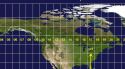
- Map of North America with Latitude and Longitude Grid
- World Map with Latitude and Longitude
- Map Scales
- Generate VCARD QR Code
- GEOCODER: Street Address to Latitude and Longitude
- BC Assessment
- CSRD Mapping
- CSRD REST Services
- Realtor.ca
- BC Government Access Tool for Online Retrieval (GATOR)
- The Land Title and Survey Authority of British Columbia